

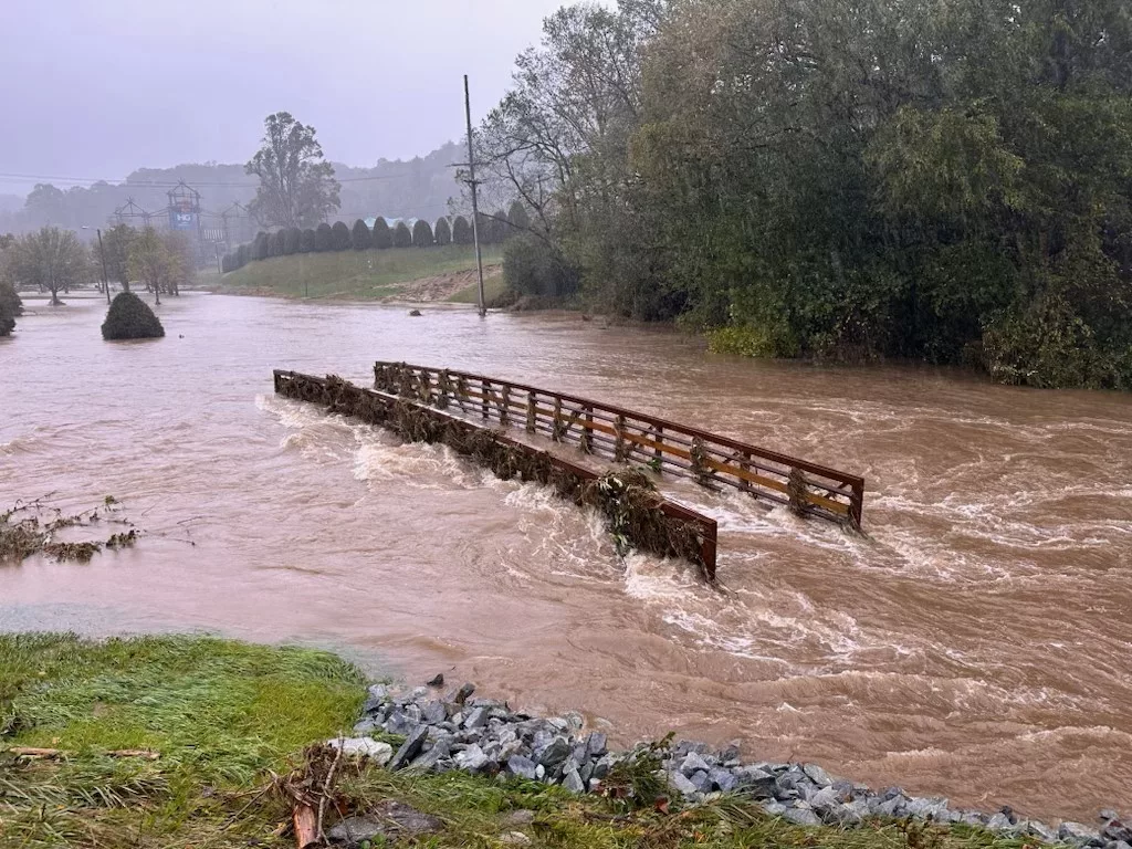
Do you live close to a stream or river? Are you looking to build or expand a deck, or build an addition to your home or business? Perhaps you wish to replace a bridge/culvert or build a new stream crossing or develop a lot whether it be residential or commercial. Before you begin any construction, you will want to find out if your project is within a FEMA floodplain. If so, you will likely need a floodplain development permit issued by your community’s Floodplain Administrator. Depending on your community’s ordinance, what type of construction activities, and where in the floodplain the construction will take place, you will likely be required to provide evidence of “No Impact”, “No Rise” or submit an “MT-2” application prior to your community issuing a permit.
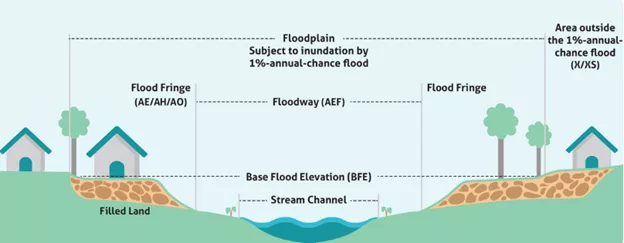
In the context of flood mapping and development, “No Impact” means a proposed project will not change existing flood elevations or floodway boundaries. “No Rise” specifically refers to a project not causing any increase in flood elevation.”MT-2″ is a request to FEMA to officially revise flood maps based on a proposed development project, essentially allowing for a map change to reflect the potential impact of the planned construction. Which type of application is suitable for your project depends on the if there is any impact to the floodway or not from your construction.
Which type of application do you need? That’s a good question. Below, we describe what the different application options are and some examples of projects that fit into each category. With more than 15 years of experience, Areté Engineers has the expertise in floodplain permitting see your project to fruition.
No Impact
“No Impact” is a broad term indicating that a project will not alter flood conditions in any measurable way, including flood elevations and floodway widths. An example of when a No Impact would be applicable is replacing a bridge or culvert that was damaged or destroyed by a flood event. If your replacement structure is a replica of the original and placed in the same spot as the original, a No Impact will likely suit your project’s needs. A No Impact application is not suitable for new (non-replacement) structures, or for structures that are larger, smaller, or in a different location than its predecessor. A No Impact based floodplain development application requires a No Impact certification signed and sealed by a licensed professional engineer and is accompanied by a narrative describing the project scope and a set of sealed construction drawings. A No Impact application provides the quickest and least-cost route to obtaining a floodplain development permit, but is generally available only for a “like-for-like” type replacement project.
No Rise
“No Rise” is a specific term stating that a project will not cause any increase in flood elevation, meaning the flood elevations will remain the same or may decrease slightly. Flood elevations may not decrease by more than 1/10th of a foot as this would require changes to FEMA’s published Base Flood Elevations. A No Rise may be an appropriate approach for small changes or additions such as residential decks, bridge or culvert replacements at the same location as an original that differs from the existing or original structure, and in some very limited circumstances, a new structure with a small footprint, such as a shed or workshop. A No Rise application requires an engineering hydraulic model analysis that demonstrates there is no increase in flood elevations between the existing (or pre-development) condition and the proposed (post-development) condition, a topographic work map of the project area showing existing and proposed development floodplain extents and floodway, a narrative describing the project and all engineering methods/assumptions used, a “No Adverse Impact” certificate signed and sealed by a licensed professional engineer, and a set of sealed construction drawings. It is unlikely that a new stream crossing (bridge or culvert) or other significant structure that would obstruct conveyance of floodwaters would qualify for a No Rise. The No Rise application requires technical review and concurrence by North Carolina Emergency Management or other local technical cooperating partner (e.g. the City of Charlotte reviews projects within their city limits) prior to the issuance of a floodplain development permit. A No Rise application usually requires 4 to 8 weeks for review/approval and the next-best cost alternative to obtaining a floodplain development permit.
MT-2
An MT-2 application is a formal request to FEMA to modify flood maps based on a proposed development project, allowing for a potential change in flood zone designations and flood elevations if the project meets specific criteria. The MT-2 involves a two-stage permitting process; A proposed (pre-construction) application known as a Conditional Letter of Map Revision (CLOMR) and a post-construction application known as a Letter of Map Revision (LOMR). The MT-2 application may be appropriate for a new bridge or culvert crossing where a crossing does not currently exist (including the relocation of an existing crossing), a moderate to large scale commercial development, development of a residential subdivision, etc.
In technical terms, CLOMR is a letter commenting on whether a proposed project, if built as shown on the submitted documentation, would meet the standards for a Flood Insurance Rate Map (FIRM) revision. Communities may require this evidence prior to issuing a permit, and the Certificate of Occupancy/Compliance is typically withheld until receipt of the final LOMR based on “as-built” documentation and certification. A LOMR is an official revision to an effective FIRM that may be issued to change flood insurance risk zones, Special Flood Hazard Areas and floodway boundary delineations, flood elevations, and other map features.
The purpose of an MT-2 is to demonstrate to FEMA how your project impacts the floodplain and floodway of the surrounding area. FEMA also requires that your project demonstrate that no insurable structure is adversely impacted, meaning that your project cannot increase the base flood elevations at any existing building already in the floodplain, nor cause any insurable structure to fall within the FEMA floodplain that previously was outside the FEMA floodplain. The MT-2 application can be costly and time consuming. Approval can take six or more months and may require environmental studies, and other permits to be issued by The Army Corps of Engineers and NC Division of Environmental Quality.
We Can Help
We understand that the process can be daunting. Let Areté Engineers help you through your floodplain permitting project. Contact us for assistance today.